
Frahan trails
Click on a trail to view its statistics, map and profile.
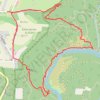
Les Échelles - Rochehaut (the Ardennes) - Route 43
Belgium > Luxembourg > Neufchâteau > Bouillon > Rochehaut > Frahan
An extremely nice short hike, probably the nicest in Belgium. Start your hike at the Church of Rochehaut — or at the beginning of the Route 43 — and follow the sign with a red rectangle on white board. Route 43 is very well marked till the end. While some slopes are steep, it’s perfectly suitable for…
Distance: 2.6 mi • Elevation gain: 817 ft • Maximum elevation: 1,260 ft