Import a GPX file

Cedar Ridge via South Kaibab Trail trails

Click on a trail to view its statistics, map and profile.
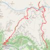
Phantom Ranch via South Kaibab Trail, Skeleton Point, Bright Angel Trail and Indian Garden

United States > Arizona > Coconino County

From the South Kaibab Trailhead near Yaki Point, the route drops into the Grand Canyon on an open ridgeline, passing Ooh Aah Point, Cedar Ridge, Skeleton Point and The Tipoff, with broad views over the South Rim cliffs, the Tonto Platform and the deepening corridor of the Colorado River. It then descends…

Distance: 19.0 mi • Elevation gain: 8,694 ft • Maximum elevation: 7,221 ft
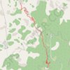
Cedar Ridge via South Kaibab Trail

United States > Arizona > Coconino County

Grand Canyon National Park. #Hiking #Canyon #Forest #Nature

Distance: 2.9 mi • Elevation gain: 1,778 ft • Maximum elevation: 7,221 ft

Skeleton Point

United States > Arizona > Coconino County

Hike to Skeleton Point via South Kaibab Trail, Ooh Aah Point and Cedar Ridge in the Grand Canyon National Park. #Hiking #Canyon #Park #Nature #Mountain #Rock #Overlook

Distance: 3.4 mi • Elevation gain: 896 ft • Maximum elevation: 7,228 ft

Gear up for your next adventure:

🗺️Topographic Maps - Detailed topo maps for hiking, exploring and outdoor navigation
🧣Merino Neck Gaiters - Multi-functional headwear for wind and sun protection
🧴Hand Sanitizer - Keep hands clean while hiking
🧦Hiking Socks - Comfortable socks to prevent blisters on long hikes
🚗GPS Dash Cams - Record your scenic drives through mountain passes and canyons

As an Amazon Associate, this site earns from qualifying purchases at no extra cost to you.