Import a GPX file

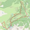
Circuit de Fontanalba trails

Click on a trail to view its statistics, map and profile.

Circuit de Fontanalba

France > Provence-Alpes-Côte d'Azur > Maritime Alps > Tende > Castérino

#Randonnée #Boucle #Mercantour #Alpes #Montagne #Nature

Distance: 9.9 mi • Elevation gain: 2,664 ft • Maximum elevation: 7,356 ft

Gear up for your next adventure:

🎒Hydration Pack - Hands‑free water reservoir for long hikes
🪶Trail Camera - Capture wildlife on your hikes
🚁Photography Drones - Capture stunning aerial views of landforms and topography
🏕️Tent Footprint - Protect your tent base from wear
🪶Camping Sleeping Pad - Comfortable sleeping pad for backpacking

As an Amazon Associate, this site earns from qualifying purchases at no extra cost to you.