Import a GPX file

Gray s Mill Loop Trail in Patapsco Valley State Park trails

Click on a trail to view its statistics, map and profile.
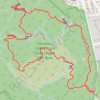
Gray's Mill Loop Trail in Patapsco Valley State Park

United States > Maryland > Baltimore County > Catonsville

Distance: 2.1 mi • Elevation gain: 161 ft • Maximum elevation: 371 ft

Gear up for your next adventure:

🌡️Handheld Weather Meters - Measure wind, temp, and pressure for safe mountain travel
🗺️NatGeo Topo Maps - High-quality waterproof printed topographic maps of US Parks
🪓Survival Multi‑Tool - Versatile tool for camp and trail tasks
🔭Telescopic Hiking Pole - Adjustable pole for hiking stability
🎒Day Hiking Backpack - Lightweight backpack perfect for day trips and outdoor adventures

As an Amazon Associate, this site earns from qualifying purchases at no extra cost to you.