
Hampshire County, Massachusetts, United States trails
Click on a trail to view its statistics, map and profile.
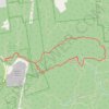
Mount Norwottuck Loop via NET/M&M Trail, Horse Cave and Robert Frost Trail in Mount Holyoke Range State Park
United States > Massachusetts > Hampshire County > Amherst
The Mount Norwottuck Loop is a moderate, scenic hike through Mount Holyoke Range State Park that leads to panoramic views of the Pioneer Valley and diverse wooded landscapes. Following the NET/M&M Trail and connecting with the Robert Frost Trail, hikers can explore the historical Horse Caves, which were…
Distance: 3.6 mi • Elevation gain: 650 ft • Maximum elevation: 1,043 ft