
Henry Wilson Trail trails
Click on a trail to view its statistics, map and profile.
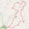
Wilson Peak and Kelly Lake Loop
United States > California > Santa Clara County
Loop hike from Hunting Hollow Trailhead via Hunting Hollow Road, Lyman Willson Ridge Trail, Steer Ridge Road, Willson Camp, Wagon Road, Grizzly Gulch Trail, Tule Pond, Wasno Road, Wasno Pond, Crest Trail, Kelly Lake Trail, Kelly Lake, Dexter Trail, Willson Peak Trail, Willson Peak and Middle Steer Ridge Trail…
Distance: 16.5 mi • Elevation gain: 4,475 ft • Maximum elevation: 2,635 ft
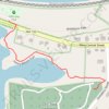
Henry Wilson Trail
United States > Massachusetts > Middlesex County > Natick
Distance: 0.4 mi • Elevation gain: 39 ft • Maximum elevation: 184 ft