John Muir Trail and Merced River Falls Loop trails
Click on a trail to view its statistics, map and profile.
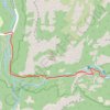
Vernal Falls
United States > California > Mariposa County > Curry Village
From Happy Isles, the route follows the John Muir Trail and Mist Trail along the Merced River, moving through forested Yosemite Valley scenery toward the narrowing granite canyon below Vernal Fall. The itinerary passes the Vernal Fall Footbridge, continues beside the river, and climbs into the Mist Trail…
Distance: 3.6 mi • Elevation gain: 1,575 ft • Maximum elevation: 5,197 ft
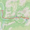
Vernal Fall and Nevada Fall
United States > California > Mariposa County > Curry Village
From Happy Isles, the hike enters the eastern end of Yosemite Valley and follows the Merced River through forest and granite scenery toward the Vernal Fall Footbridge, where the first open views of the river and surrounding canyon set the tone for one of Yosemite’s most iconic waterfall routes. The Mist…
Distance: 2.9 mi • Elevation gain: 2,228 ft • Maximum elevation: 6,007 ft
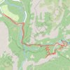
Vernal Fall and Clark Point Loop
United States > California > Mariposa County > Curry Village
The route follows the river upstream toward the waterfall approach, passing through a lively canyon setting shaped by clear pools, polished rock and constant movement from the Merced. The hike then joins the Mist Trail, where the scenery becomes more dramatic beneath Vernal Fall, with spray, stone steps, cliff…
Distance: 5.9 mi • Elevation gain: 2,644 ft • Maximum elevation: 5,574 ft
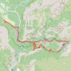
Nevada Fall Loop
United States > California > Mariposa County > Curry Village
Loop hike from Curry Village to Nevada Fall via Happy Isles Bridge, Merced River, John Muir Trail, Mist Trail, Vernal Fall and Clark Point in the Yosemite National Park. #Hiking #Loop #Mountain #River #Falls #Nature #Forest #Park #Yosemite
Distance: 8.9 mi • Elevation gain: 3,783 ft • Maximum elevation: 6,066 ft