
Lone Eagle Peak Pawnee Pass trails
Click on a trail to view its statistics, map and profile.
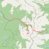
Lone Eagle Peak - Pawnee Pass
United States > Colorado > Grand County
From the Lake Granby side, this traverse begins near Monarch Lake and follows the Cascade Creek corridor into the Indian Peaks Wilderness, passing forested shoreline, Arapaho Pass Trail junction, Buchanan Creek, Cascade Creek, and waterfall-lined sections of the valley. Beyond the Cascade Creek basin, the…
Distance: 20.4 mi • Elevation gain: 6,581 ft • Maximum elevation: 12,546 ft