Import a GPX file

Mount Le Conte High Top trails

Click on a trail to view its statistics, map and profile.
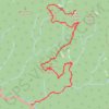
Mount Le Conte - High Top

United States > Tennessee > Sevier County

Hike from Alum Cave Bluffs Trailhead to Mount Le Conte via Walker Camp Prong, Alum Cave Trail, Peregrine Peak, Cliff Top, Bull Head Trail and Boulevard Trail in the Great Smoky Mountains National Park. #Hiking #Mountain #Nature #Forest

Distance: 11.2 mi • Elevation gain: 4,613 ft • Maximum elevation: 6,542 ft

Gear up for your next adventure:

🚗GPS Dash Cams - Record your scenic drives through mountain passes and canyons
🌡️Handheld Weather Meters - Measure wind, temp, and pressure for safe mountain travel
🧴Hand Sanitizer - Keep hands clean while hiking
📶Vehicle Signal Boosters - Improve reception in rural areas while driving to trailheads
🎒Gear Packing Cubes - Organize your backpack efficiently

As an Amazon Associate, this site earns from qualifying purchases at no extra cost to you.