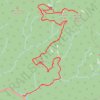
Mount LeConte via Alum Cave Trail trails
Click on a trail to view its statistics, map and profile.

Mount LeConte via Alum Cave Trail
United States > Tennessee > Sevier County
From the Alum Cave Trailhead on Newfound Gap Road, this demanding Mount LeConte route climbs through shaded old-growth forest beside Alum Cave Creek and mountain streams before passing through Arch Rock. Beyond the rock passage, the trail steepens toward Alum Cave Bluffs, a dramatic overhanging cliff rather…
Distance: 10.8 mi • Elevation gain: 3,848 ft • Maximum elevation: 6,542 ft
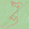
Mount LeConte and Myrtle Point via Alum Cave Trail
United States > Tennessee > Sevier County
The Alum Cave Trail to Mount LeConte and Myrtle Point in Great Smoky Mountains National Park offers hikers a journey through diverse natural landmarks, including Arch Rock and Alum Cave Bluff. As the trail ascends, it provides expansive vistas of the Great Smoky Mountains, leading to the LeConte Lodge near the…
Distance: 11.9 mi • Elevation gain: 3,960 ft • Maximum elevation: 6,542 ft


Mount LeConte and Cliff Top via Alum Cave Trail in Great Smoky Mountains National Park
United States > Tennessee > Sevier County
The hike to Mount LeConte and Cliff Top via Alum Cave Trail is a challenging yet rewarding journey through some of the most iconic landscapes in the Great Smoky Mountains National Park. The trail passes notable landmarks like Arch Rock and Alum Cave Bluff, with expansive mountain views from Inspiration Point.…
Distance: 11.6 mi • Elevation gain: 3,871 ft • Maximum elevation: 6,542 ft
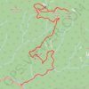
Mount LeConte, Myrtle Point and Cliff Top via Alum Cave Trail
United States > Tennessee > Sevier County
The Alum Cave Trail to Mount LeConte offers a stunning and challenging hike through the Great Smoky Mountains. Starting with gentle inclines through lush forest, highlights include crossing Alum Cave Creek, the natural arch of Arch Rock, and panoramic views from Inspiration Point. Beyond the iconic Alum Cave…
Distance: 12.0 mi • Elevation gain: 3,957 ft • Maximum elevation: 6,542 ft