Import a GPX file

Reynolds County, Missouri, United States trails

Click on a trail to view its statistics, map and profile.
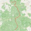
Ozark Trail 100 Mile Endurance Run

United States > Missouri > Reynolds County

Distance: 98.0 mi • Elevation gain: 11,178 ft • Maximum elevation: 1,391 ft

Gear up for your next adventure:

🪶Compact Camp Shovel - Folding shovel for campsite tasks
🪶Camping Sleeping Pad - Comfortable sleeping pad for backpacking
🌡️Portable Weather Meter - Track weather conditions on the trail
🔪Outdoor Multitools - Essential survival tools for gear repair and field use
🥾Men's Hiking Boots - Durable, waterproof footwear for rugged terrain and steep inclines

As an Amazon Associate, this site earns from qualifying purchases at no extra cost to you.