Import a GPX file

Tomyhoi Peak Yellow Aster Butte trails

Click on a trail to view its statistics, map and profile.

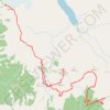
Tomyhoi Peak - Yellow Aster Butte

United States > Washington > Whatcom County

Mount Baker Wilderness. #Hiking #Baker

Distance: 13.6 mi • Elevation gain: 5,646 ft • Maximum elevation: 7,333 ft

Gear up for your next adventure:

🕶️Glacier Sunglasses - Side shields to protect eyes from high-altitude snow glare
📡Handheld GPS Device - Reliable handheld GPS for outdoor navigation
🧦Hiking Socks - Comfortable socks to prevent blisters on long hikes
🪄Magnetic Compass - Accurate compass for navigation
🏔️Mountain Trail Maps - High‑detail maps for popular peaks

As an Amazon Associate, this site earns from qualifying purchases at no extra cost to you.