
Bright Angel Trail to 3 Mile Resthouse trails
Click on a trail to view its statistics, map and profile.
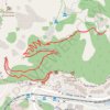
1.5 Mile Resthouse (Grand Canyon)
United States > Arizona > Coconino County > Grand Canyon Village
From Grand Canyon Village, the route leaves the rim near Bright Angel Lodge and drops onto the Bright Angel Trail, quickly entering the shaded upper canyon through tight switchbacks and broad South Rim viewpoints. The path continues across pale cliffs, wooded pockets and exposed canyon slopes, following one of…
Distance: 1.6 mi • Elevation gain: 630 ft • Maximum elevation: 6,841 ft
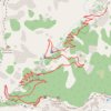
3 Mile Resthouse (Grand Canyon)
United States > Arizona > Coconino County > Grand Canyon Village
From Grand Canyon Village, the route leaves the South Rim at the Bright Angel Trailhead near the historic rim area and drops onto the Bright Angel Trail, one of the park’s classic corridor trails, used through time by Indigenous peoples, miners, early tourists, hikers, and mule parties. The descent quickly…
Distance: 3.0 mi • Elevation gain: 860 ft • Maximum elevation: 6,841 ft
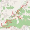
3-Mile Resthouse via Bright Angel Trail in Grand Canyon National Park
United States > Arizona > Coconino County > Grand Canyon Village
Hiking the Bright Angel Trail to the 3-Mile Resthouse offers an intimate journey into the Grand Canyon's depths, showcasing the vastness of its ancient rock formations. As you descend, the towering canyon walls envelop you, revealing layers of geological history and offering glimpses of the winding Colorado…
Distance: 6.4 mi • Elevation gain: 3,743 ft • Maximum elevation: 6,847 ft
