
Walk Danehill Horsted Keynes trails
Click on a trail to view its statistics, map and profile.
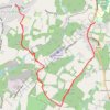
Walk - Danehill, Horsted Keynes
United Kingdom > England > East Sussex > Wealden > Danehill
Distance: 7.8 mi • Elevation gain: 745 ft • Maximum elevation: 387 ft

Walk - Danehill, Chelwood Gate, Birchgrove, Horsted Keynes
United Kingdom > England > East Sussex > Wealden > Danehill
Danehill, Chelwood Gate, Birchgrove, Horsted Keynes
Distance: 9.9 mi • Elevation gain: 1,129 ft • Maximum elevation: 515 ft

Walk - Horsted Keynes, Danehill, Heaven Farm
United Kingdom > England > West Sussex > Mid Sussex > Horsted Keynes
Distance: 8.1 mi • Elevation gain: 925 ft • Maximum elevation: 410 ft

Loop Walk - Danehill, Chelwood Gate, Birchgrove, Horsted Keynes
United Kingdom > England > East Sussex > Wealden > Danehill
Distance: 11.1 mi • Elevation gain: 1,237 ft • Maximum elevation: 515 ft