Import a GPX file

Mount Nebo and North Peak trails

Click on a trail to view its statistics, map and profile.
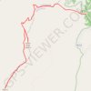
Mount Nebo and North Peak

United States > Utah > Utah County

Wolf Pass. Rocky Mountains. #Hiking #RockyMoutains

Distance: 9.5 mi • Elevation gain: 4,121 ft • Maximum elevation: 11,877 ft

Gear up for your next adventure:

📶Satellite Messenger - Communication device off‑grid
🧭Hiking Compass - Precision compass for reliable navigation in the wilderness
🌐World Map Poster - Decorative world maps with topographic info
🔪Outdoor Multitools - Essential survival tools for gear repair and field use
🖼️Topo Map Wall Art - Decorative topographic prints of famous peaks and regions

As an Amazon Associate, this site earns from qualifying purchases at no extra cost to you.