
Rocky Narrows area trails
Click on a trail to view its statistics, map and profile.
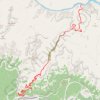
Pipe Creek Beach via Bright Angel Trail
United States > Arizona > Coconino County > Grand Canyon Village
From Grand Canyon Village on the South Rim, this route begins at the Bright Angel Trailhead and descends beneath the rim through a dramatic chain of switchbacks, with widening views across the canyon walls and the layered cliffs of the Bright Angel fault corridor. It passes the resthouse section of the upper…
Distance: 15.7 mi • Elevation gain: 7,300 ft • Maximum elevation: 6,841 ft

Rocky Narrows area
United States > Massachusetts > Middlesex County > Newton
More investigations
Distance: 46.0 mi • Elevation gain: 2,188 ft • Maximum elevation: 344 ft