Import a GPX file

Santa Catalina Island trails

Click on a trail to view its statistics, map and profile.
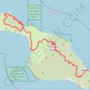
Trans Catalina Trail (TCT)

United States > California > Los Angeles County > Avalon > Pebbly Beach

The Trans-Catalina Trail begins in Avalon, leaving the island’s lively harbor town to climb into the dry, rugged interior of Santa Catalina Island. The route passes Haypress Reservoir and Cape Canyon Reservoir before entering the Black Jack backcountry and continuing toward Catalina Airport, often known as…

Distance: 38.7 mi • Elevation gain: 9,272 ft • Maximum elevation: 1,742 ft
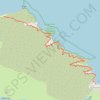
Santa Catalina Island

United States > California > Los Angeles County > Two Harbors

Hike from Two Harbors to Parsons Landing campsite. #Hiking #Island #Catalina #Pacific #Ocean #Sea #Nature #Forest

Distance: 7.6 mi • Elevation gain: 1,742 ft • Maximum elevation: 240 ft

Gear up for your next adventure:

🪓Survival Multi‑Tool - Versatile tool for camp and trail tasks
🦶Hiking Gaiters - Keep debris and water out of your boots
🪶Wildlife Field Guides - Learn animal tracking and species ID
🎒Outdoor Daypacks - Lightweight backpacks designed for carrying maps and essential gear
🥇GPS Hiking Watch - Multi‑sport GPS watch with navigation and trail tracking

As an Amazon Associate, this site earns from qualifying purchases at no extra cost to you.