Import a GPX file

Sooke trails

Click on a trail to view its statistics, map and profile.
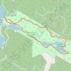
Broom Hill Loop

Canada > British Columbia > Capital Regional District > Sooke

Vancouver Island. #Hiking #Running #Loop #BroomHill #Vancouver

Distance: 3.1 mi • Elevation gain: 663 ft • Maximum elevation: 896 ft

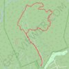
Matheson Lake - Roche Cove

Canada > British Columbia > Capital Regional District > Sooke

Roche Cove Regional Park. #Hiking #Loop #RocheCove

Distance: 5.6 mi • Elevation gain: 846 ft • Maximum elevation: 404 ft

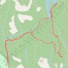
Mount Manuel Quimper

Canada > British Columbia > Capital Regional District > Sooke

Sea to Sea Regional Park. #Hiking #MTB #Running #Loop #SeaToSea

Distance: 6.2 mi • Elevation gain: 1,509 ft • Maximum elevation: 1,732 ft

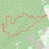
Lunch Peak and Peden Lake loop from Sooke River in Sea to Sea Regional Park

Canada > British Columbia > Capital Regional District > Sooke

Distance: 5.2 mi • Elevation gain: 1,168 ft • Maximum elevation: 1,250 ft

Gear up for your next adventure:

📚Navigation Handbooks - Master the art of reading topographic maps and using a compass
🥇GPS Hiking Watch - Multi‑sport GPS watch with navigation and trail tracking
🔭Telescopic Hiking Pole - Adjustable pole for hiking stability
🥾Men's Hiking Boots - Durable, waterproof footwear for rugged terrain and steep inclines
🌡️Handheld Weather Meters - Measure wind, temp, and pressure for safe mountain travel

As an Amazon Associate, this site earns from qualifying purchases at no extra cost to you.