Import a GPX file

Les Houches trails

Click on a trail to view its statistics, map and profile.
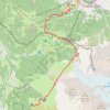
Day 01: Les Houches to Auberge du Truc

France > Auvergne-Rhône-Alpes > Upper Savoy > Les Houches > Le Fouilly

Distance: 8.8 mi • Elevation gain: 4,856 ft • Maximum elevation: 6,946 ft

Gear up for your next adventure:

🧯Emergency Survival Kit - All‑in‑one survival essentials for the backcountry
🌡️Handheld Weather Meters - Measure wind, temp, and pressure for safe mountain travel
🏫Relief Map Kits - Hands-on tools for teaching landforms and elevation
🥘Titanium Cookware - Durable, featherlight pots and pans for backpacking
🛰️Satellite Messengers - Emergency SOS and two-way messaging for off-grid adventures

As an Amazon Associate, this site earns from qualifying purchases at no extra cost to you.