Import a GPX file

Derry/Londonderry trails

Click on a trail to view its statistics, map and profile.
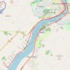
Foyle Valley Cycle Route

United Kingdom > Northern Ireland > County Londonderry > Derry/Londonderry

Distance: 5.2 mi • Elevation gain: 207 ft • Maximum elevation: 125 ft

Gear up for your next adventure:

🧭Outdoor Navigation Book - Learn advanced navigation skills
🧴Hand Sanitizer - Keep hands clean while hiking
📻Weather Alert Radios - Stay informed of storm risks while off-the-grid
🧭Orienteering Set - Complete compass and map reading kit
☕Camping Coffee Makers - Enjoy premium coffee at the summit or campsite

As an Amazon Associate, this site earns from qualifying purchases at no extra cost to you.