Import a GPX file

Danville trails

Click on a trail to view its statistics, map and profile.
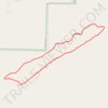
Danville Mountain Trail (Upper Loop, Extended) in Ouachita National Forest

United States > Arkansas > Yell County > Danville

Distance: 2.7 mi • Elevation gain: 479 ft • Maximum elevation: 1,070 ft
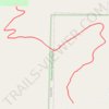
Danville Mountain Trail (Lower Section) in Ouachita National Forest

United States > Arkansas > Yell County > Danville

Distance: 1.3 mi • Elevation gain: 387 ft • Maximum elevation: 738 ft

Gear up for your next adventure:

🧥Men's Rain Shells - Premium waterproof and breathable jackets for mountain weather
🎒Waterproof Dry Bags - Keep your electronics and maps dry inside your pack
🏕️Family Camping Gear - Essentials for group camping trips
🧭Pro Hiking Compasses - High-accuracy liquid-filled compasses for topographic orientation
❄️Traction Cleats - Prevent slips on icy trails during winter hikes

As an Amazon Associate, this site earns from qualifying purchases at no extra cost to you.