Import a GPX file

Hayfield trails

Click on a trail to view its statistics, map and profile.
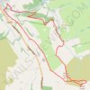
Mount Famine and South Head loop hike from Hayfield

United Kingdom > England > Derbyshire > High Peak > Hayfield

Distance: 5.7 mi • Elevation gain: 1,365 ft • Maximum elevation: 1,604 ft

Gear up for your next adventure:

🔋Rechargeable Batteries - Power up your outdoor devices
🪶Multi‑Purpose Knife - Useful blade for camp and trail
📶Vehicle Signal Boosters - Improve reception in rural areas while driving to trailheads
📚Navigation Handbooks - Master the art of reading topographic maps and using a compass
🕶️Glacier Sunglasses - Side shields to protect eyes from high-altitude snow glare

As an Amazon Associate, this site earns from qualifying purchases at no extra cost to you.