
Baldwins Crossing trails
Click on a trail to view its statistics, map and profile.
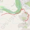
Cathedral Rock Trail via Baldwin Trail and Templeton Trail in Coconino National Forest
United States > Arizona > Yavapai County > Baldwins Crossing
The Cathedral Rock Trail via Baldwin and Templeton Trails offers a peaceful and scenic approach to one of Sedona’s most iconic landmarks. Hikers follow a path lined with red rock formations, pinyon pines, and junipers, with occasional views of Oak Creek's lush greenery adding contrast to the desert…
Distance: 3.8 mi • Elevation gain: 902 ft • Maximum elevation: 4,721 ft