Import a GPX file

Old Bennington trails

Click on a trail to view its statistics, map and profile.
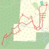
Mount Anthony from Southern Vermont College

United States > Vermont > Bennington County > Bennington > Old Bennington

Distance: 4.9 mi • Elevation gain: 1,575 ft • Maximum elevation: 2,323 ft

Gear up for your next adventure:

🏫Relief Map Kits - Hands-on tools for teaching landforms and elevation
🔭Stargazing Telescopes - Perfect for camping in low-light pollution areas shown on maps
🦶Carbon Trekking Poles - Reduce knee impact on steep descents with ultra-light poles
🩹Survival Bandages - High‑quality bandages for emergencies
🚁Photography Drones - Capture stunning aerial views of landforms and topography

As an Amazon Associate, this site earns from qualifying purchases at no extra cost to you.