Import a GPX file

Town of Collins trails

Click on a trail to view its statistics, map and profile.
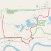
Hiking trails in the Zoar Valley Unique Area

United States > New York > Erie County > Town of Collins

Distance: 2.3 mi • Elevation gain: 338 ft • Maximum elevation: 1,414 ft

Gear up for your next adventure:

🚁Photography Drones - Capture stunning aerial views of landforms and topography
🧭Orienteering Set - Complete compass and map reading kit
📶Satellite Messenger - Communication device off‑grid
🥘Titanium Cookware - Durable, featherlight pots and pans for backpacking
🧥Men's Rain Shells - Premium waterproof and breathable jackets for mountain weather

As an Amazon Associate, this site earns from qualifying purchases at no extra cost to you.