Import a GPX file

Mugdock trails

Click on a trail to view its statistics, map and profile.
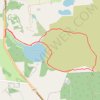
Trails at Loch Ardinning

United Kingdom > Scotland > Stirling > Strathblane > Mugdock

Distance: 2.5 mi • Elevation gain: 161 ft • Maximum elevation: 568 ft
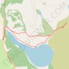
Trails around Loch Ardinning

United Kingdom > Scotland > Stirling > Strathblane > Mugdock

Distance: 1.4 mi • Elevation gain: 89 ft • Maximum elevation: 505 ft

Gear up for your next adventure:

🩳Quick‑Dry Hiking Shorts - Comfortable and quick‑dry shorts for summer hiking
🥾Women's Hiking Boots - Top-rated trail boots with ankle support and superior grip
💧Water Purification System - Clean water on the trail with reliable purifiers
🪶LED Camping Lantern - Bright lantern for camp lighting
🎒Hydration Pack - Hands‑free water reservoir for long hikes

As an Amazon Associate, this site earns from qualifying purchases at no extra cost to you.