Import a GPX file

Knodishall trails

Click on a trail to view its statistics, map and profile.
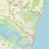
Suffolk Coast Path: Thorpeness to Aldeburgh

United Kingdom > England > Suffolk > East Suffolk > Knodishall

Distance: 13.5 mi • Elevation gain: 381 ft • Maximum elevation: 79 ft

Gear up for your next adventure:

🔥Plasma Lighters - Windproof lighters that work in any weather condition
👟Men's Trail Runners - Lightweight footwear for fast-paced exploration and light hiking
🕶️Glacier Sunglasses - Side shields to protect eyes from high-altitude snow glare
🚁Photography Drones - Capture stunning aerial views of landforms and topography
📶Satellite Messenger - Communication device off‑grid

As an Amazon Associate, this site earns from qualifying purchases at no extra cost to you.