Import a GPX file

Hole Bottom trails

Click on a trail to view its statistics, map and profile.
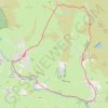
Hebden to Grassington loop via River Wharfe, back by Moors

United Kingdom > England > North Yorkshire > Hebden > Hole Bottom

Distance: 7.9 mi • Elevation gain: 778 ft • Maximum elevation: 1,135 ft

Gear up for your next adventure:

🌐World Map Poster - Decorative world maps with topographic info
🧥Waterproof Jacket for Hiking - Breathable and rugged rain jacket for outdoor excursions
🪑Ultralight Camp Chairs - Portable seating for resting after a long day of mapping
🔋Solar Power Banks - Keep your GPS and phone charged in remote wilderness areas
❄️Traction Cleats - Prevent slips on icy trails during winter hikes

As an Amazon Associate, this site earns from qualifying purchases at no extra cost to you.