Import a GPX file

Carsac-Aillac trails

Click on a trail to view its statistics, map and profile.
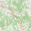
Voie Verte Périgord Quercy - De Aillac à Sarlat-la-Canéda

France > Nouvelle-Aquitaine > Dordogne > Carsac-Aillac > Aillac

Distance: 7.7 mi • Elevation gain: 610 ft • Maximum elevation: 515 ft

Other places

Gear up for your next adventure:

🧯Emergency Survival Kit - All‑in‑one survival essentials for the backcountry
🔥Plasma Lighters - Windproof lighters that work in any weather condition
📌Outdoor GPS Map App - Apps and devices for digital topographic navigation
🔥Fast-Boil Camping Stoves - Efficient cooking systems for quick trail meals
🧯Portable Fire Pit - Compact fire pit for camping spots

As an Amazon Associate, this site earns from qualifying purchases at no extra cost to you.