
Ashburnham trails
Click on a trail to view its statistics, map and profile.
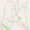
Mount Watatic and Nutting Hill Loop via Wapack Trail, Mid State Trail and State Line Trail in Watatic Mountain Wildlife Sanctuary
United States > Massachusetts > Worcester County > Ashburnham
The Mount Watatic Loop offers a beautiful New England hiking experience, combining forested paths with rewarding summit views. Following the Wapack, Mid State, and State Line trails, the route brings you to the peak of Mount Watatic, where on clear days, you can enjoy wide vistas stretching from Mount…
Distance: 2.8 mi • Elevation gain: 666 ft • Maximum elevation: 1,788 ft