Import a GPX file

Lakewood trails

Click on a trail to view its statistics, map and profile.
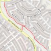
Trail from S Coors St to W Jewell Ave. "Loveland Trail"

United States > Colorado > Jefferson County > Lakewood

Distance: 0.7 mi • Elevation gain: 164 ft • Maximum elevation: 6,024 ft

Gear up for your next adventure:

👖Convertible Hiking Pants - Versatile zip-off pants for changing altitudes and temperatures
🔭Telescopic Hiking Pole - Adjustable pole for hiking stability
🧭Hiking Compass - Precision compass for reliable navigation in the wilderness
🪶Wildlife Field Guides - Learn animal tracking and species ID
🏕️Tent Footprint - Protect your tent base from wear

As an Amazon Associate, this site earns from qualifying purchases at no extra cost to you.