Import a GPX file

Camden County trails

Click on a trail to view its statistics, map and profile.
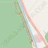
Canal Road and Supple Jack Trail Loop in Dismal Swamp State Park

United States > North Carolina > Camden County

Distance: 2.1 mi • Elevation gain: 39 ft • Maximum elevation: 36 ft

Gear up for your next adventure:

📱Solar Portable Charger - Solar power bank for charging devices off‑grid
🪶Survival Guide Book - Expert advice for emergency preparedness
🌡️Handheld Weather Meters - Measure wind, temp, and pressure for safe mountain travel
🧥Men's Rain Shells - Premium waterproof and breathable jackets for mountain weather
⌚Solar GPS Watches - Advanced multisport watches with built-in topographic maps

As an Amazon Associate, this site earns from qualifying purchases at no extra cost to you.