Import a GPX file

Westwood trails

Click on a trail to view its statistics, map and profile.
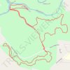
Hike - Southern Old Stone Fort Park Trails

United States > Tennessee > Coffee County > Manchester > Westwood

Distance: 4.5 mi • Elevation gain: 338 ft • Maximum elevation: 1,106 ft

Gear up for your next adventure:

🥾Men's Hiking Boots - Durable, waterproof footwear for rugged terrain and steep inclines
📌Outdoor GPS Map App - Apps and devices for digital topographic navigation
⌚GPS Sports Watch - GPS watch for running, hiking and training
🧺Microfiber Travel Towels - Compact and fast-drying towels for trail use
📻Weather Alert Radios - Stay informed of storm risks while off-the-grid

As an Amazon Associate, this site earns from qualifying purchases at no extra cost to you.