Import a GPX file

Sulphur Springs trails

Click on a trail to view its statistics, map and profile.
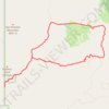
Alamao Canyon Loop in Valles Caldera National Preserve

United States > New Mexico > Sandoval County > Sulphur Springs

Distance: 11.9 mi • Elevation gain: 1,699 ft • Maximum elevation: 9,419 ft

Gear up for your next adventure:

📌Outdoor GPS Map App - Apps and devices for digital topographic navigation
👟Men's Trail Runners - Lightweight footwear for fast-paced exploration and light hiking
🧢Outdoor Hiking Hat - Sun protection hat for outdoor explorers
🧯Portable Fire Pit - Compact fire pit for camping spots
📦Dry Bags Set - Waterproof storage for electronics and clothes

As an Amazon Associate, this site earns from qualifying purchases at no extra cost to you.