
Gila County trails
Click on a trail to view its statistics, map and profile.
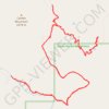
Reynolds Creek, Center Mountain, Lucky Strike Trails
United States > Arizona > Gila County
Sierra Ancha Wilderness
Distance: 12.6 mi • Elevation gain: 3,717 ft • Maximum elevation: 7,513 ft
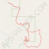
Reynolds, Murphy, Rim, Moody Point Trails
United States > Arizona > Gila County
Sierra Ancha Wilderness
Distance: 14.0 mi • Elevation gain: 3,504 ft • Maximum elevation: 7,740 ft
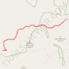
Hells Hole Trail to Boyer Trail
United States > Arizona > Gila County
Distance: 12.4 mi • Elevation gain: 2,825 ft • Maximum elevation: 5,577 ft