Import a GPX file

Toogoolawah trails

Click on a trail to view its statistics, map and profile.

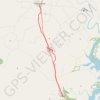
Brisbane Valley Rail Trail: Toogoolawah - Esk

Australia > Queensland > Toogoolawah

#Hiking #Bike #BVRT

Distance: 11.9 mi • Elevation gain: 420 ft • Maximum elevation: 584 ft

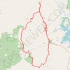
Toogoolawah - Esk - Kipper Creek

Australia > Queensland > Toogoolawah

Esk National Park. Brisbane Valley Rail Trail. #MTB #Loop #Esk #Brisbane #BVRT #Kipper

Distance: 47.5 mi • Elevation gain: 2,641 ft • Maximum elevation: 1,004 ft

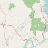
Toogoolawah - Lake Somerset

Australia > Queensland > Toogoolawah

#Bike #Somerset

Distance: 27.5 mi • Elevation gain: 1,795 ft • Maximum elevation: 673 ft

Gear up for your next adventure:

⛑️Personal Locator Beacon - Safety beacon for emergencies
🛠️Outdoor Gear Repair Kit - Essential tools to fix gear on the trail
🌐World Map Poster - Decorative world maps with topographic info
🦺Reflective Outdoor Gear - Safety gear for low‑light conditions
🚗GPS Dash Cams - Record your scenic drives through mountain passes and canyons

As an Amazon Associate, this site earns from qualifying purchases at no extra cost to you.