Import a GPX file

Le Grand-Bornand trails

Click on a trail to view its statistics, map and profile.
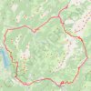
Dag 3: Forclaz - Aravis

France > Auvergne-Rhône-Alpes > Upper Savoy > Le Grand-Bornand > Le Mont

Distance: 64.0 mi • Elevation gain: 9,619 ft • Maximum elevation: 4,882 ft

Other places

Gear up for your next adventure:

🧤Hiking Gloves - Protective gloves for rugged trails
🎒Outdoor Daypacks - Lightweight backpacks designed for carrying maps and essential gear
🧭Compass with Lanyard - Easy‑carry compass for navigation
🧭Map Reading Tools - Tools and kits for map navigation
🚑Emergency Bivvies - Heat-reflective sleeping bags for survival situations

As an Amazon Associate, this site earns from qualifying purchases at no extra cost to you.