Import a GPX file

Langbank Holdings trails

Click on a trail to view its statistics, map and profile.
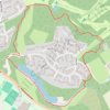
Trails around Milngavie

United Kingdom > Scotland > East Dunbartonshire > Milngavie > Langbank Holdings

Distance: 1.7 mi • Elevation gain: 138 ft • Maximum elevation: 246 ft

Gear up for your next adventure:

📱Heavy-Duty Phone Cases - Drop-proof and waterproof protection for outdoor navigation
🛰️Satellite Messengers - Emergency SOS and two-way messaging for off-grid adventures
🧭Map Reading Tools - Tools and kits for map navigation
🥾Hiking Shoes - Durable and comfortable shoes for trail hiking
🪶Multi‑Purpose Knife - Useful blade for camp and trail

As an Amazon Associate, this site earns from qualifying purchases at no extra cost to you.