Import a GPX file

Emek HaYarden Regional Council trails

Click on a trail to view its statistics, map and profile.
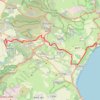
Cycling from the Kineret to Tefahot

Israel > North District > Emek HaYarden Regional Council

Distance: 13.0 mi • Elevation gain: 1,572 ft • Maximum elevation: 390 ft

Gear up for your next adventure:

🖼️Topo Map Wall Art - Decorative topographic prints of famous peaks and regions
📻Weather Alert Radios - Stay informed of storm risks while off-the-grid
🩹Survival Bandages - High‑quality bandages for emergencies
🧥Waterproof Jacket for Hiking - Breathable and rugged rain jacket for outdoor excursions
🛠️Backpacking Tool Kit - Essential toolkit for outdoor repairs

As an Amazon Associate, this site earns from qualifying purchases at no extra cost to you.