Import a GPX file

Midland County trails

Click on a trail to view its statistics, map and profile.
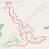
Verity Creek Loop Trail in Au Sable State Forest - Gladwin Unit

United States > Michigan > Midland County

Distance: 2.0 mi • Elevation gain: 30 ft • Maximum elevation: 673 ft

Gear up for your next adventure:

📌Outdoor GPS Map App - Apps and devices for digital topographic navigation
🌎3D Topographic Globes - Raised relief globes for a tactile understanding of geography
🚑Emergency Bivvies - Heat-reflective sleeping bags for survival situations
🧭Map Reading Tools - Tools and kits for map navigation
🪶Camping Sleeping Pad - Comfortable sleeping pad for backpacking

As an Amazon Associate, this site earns from qualifying purchases at no extra cost to you.