Import a GPX file

Osecina Municipality trails

Click on a trail to view its statistics, map and profile.
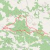
Sokolske planine

Serbia > Central Serbia > Kolubara Administrative District > Osecina Municipality > Skadar

Distance: 16.1 mi • Elevation gain: 4,462 ft • Maximum elevation: 3,173 ft
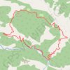
Tisovik - reka Ljubovidja

Serbia > Central Serbia > Kolubara Administrative District > Osecina Municipality > Dragodol

Distance: 7.2 mi • Elevation gain: 2,290 ft • Maximum elevation: 3,104 ft

Other places

 •

Gear up for your next adventure:

🪓Survival Multi‑Tool - Versatile tool for camp and trail tasks
🧣Merino Neck Gaiters - Multi-functional headwear for wind and sun protection
🚁Photography Drones - Capture stunning aerial views of landforms and topography
📷Action Cameras - Rugged cameras to document your journeys across rugged terrain
🏔️Mountain Trail Maps - High‑detail maps for popular peaks

As an Amazon Associate, this site earns from qualifying purchases at no extra cost to you.