
Tai Wai Village trails
Click on a trail to view its statistics, map and profile.
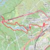
Lower Shing Mun
China > Hong Kong > Sha Tin District > Tai Wai Village
Distance: 6.2 mi • Elevation gain: 1,562 ft • Maximum elevation: 502 ft

穀寮 香粉寮左坑
China > Hong Kong > Sha Tin District > Tai Wai Village
Distance: 3.4 mi • Elevation gain: 1,115 ft • Maximum elevation: 810 ft
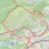
針山
China > Hong Kong > Sha Tin District > Tai Wai Village
Hiking
Distance: 6.2 mi • Elevation gain: 2,070 ft • Maximum elevation: 1,581 ft
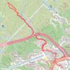
Seven Chord
China > Hong Kong > Sha Tin District > Tai Wai Village
Distance: 2.9 mi • Elevation gain: 902 ft • Maximum elevation: 892 ft
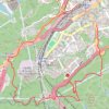
Lion Rock Country Park
China > Hong Kong > Sha Tin District > Tai Wai Village
Distance: 4.7 mi • Elevation gain: 1,243 ft • Maximum elevation: 538 ft