Import a GPX file

Livingston trails

Click on a trail to view its statistics, map and profile.
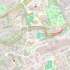
River Almond riverside paths

United Kingdom > Scotland > West Lothian > Livingston

Distance: 3.0 mi • Elevation gain: 112 ft • Maximum elevation: 371 ft
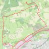
Beecraigs Hill Riccarton Hill Cairn

United Kingdom > Scotland > West Lothian > Livingston

Distance: 15.9 mi • Elevation gain: 1,234 ft • Maximum elevation: 961 ft

Gear up for your next adventure:

🛌Ultralight Sleeping Bags - Compact down bags for cold nights in the wilderness
🔥Plasma Lighters - Windproof lighters that work in any weather condition
🔥Camping Stove - Portable stove for camping and backcountry cooking
🦶Hiking Gaiters - Keep debris and water out of your boots
🕶️GPS Smartphone Mount - Secure mount for phone navigation

As an Amazon Associate, this site earns from qualifying purchases at no extra cost to you.