Import a GPX file

Marlo trails

Click on a trail to view its statistics, map and profile.

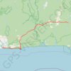
Marlo - Cape Conran Costal Park - Lind National Park - Drummer Creek

Australia > Victoria > Marlo

#Bike #Conran #Lind

Distance: 59.2 mi • Elevation gain: 4,518 ft • Maximum elevation: 1,115 ft

Gear up for your next adventure:

🕶️GPS Smartphone Mount - Secure mount for phone navigation
🥄Camping Utensil Set - Lightweight utensils for outdoor meals
🪶Wildlife Field Guides - Learn animal tracking and species ID
📷Action Camera - Capture your outdoor adventures in HD
📌Outdoor GPS Map App - Apps and devices for digital topographic navigation

As an Amazon Associate, this site earns from qualifying purchases at no extra cost to you.