Import a GPX file

Jacksonville trails

Click on a trail to view its statistics, map and profile.
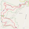
Quiverheart Falls Trail and Whispering Fern Trail Loop at Quiverheart Gorge Nature Reserve

United States > Ohio > Adams County > Jacksonville

Distance: 3.1 mi • Elevation gain: 338 ft • Maximum elevation: 823 ft

Gear up for your next adventure:

📡GPS Antenna Upgrade - Enhance GPS reception in remote terrain
🎒Outdoor Daypacks - Lightweight backpacks designed for carrying maps and essential gear
👟Men's Trail Runners - Lightweight footwear for fast-paced exploration and light hiking
🧣Hiking Neck Gaiter - Multi‑use neck protection for outdoor weather
🗃️Trail First Aid Kit - Essential kit for outdoor injuries and emergencies

As an Amazon Associate, this site earns from qualifying purchases at no extra cost to you.