Import a GPX file

Dunwich trails

Click on a trail to view its statistics, map and profile.
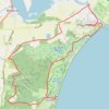
Suffolk Coast Path - Dunwich to Walberwick Loop

United Kingdom > England > Suffolk > East Suffolk > Dunwich

Distance: 13.9 mi • Elevation gain: 410 ft • Maximum elevation: 72 ft
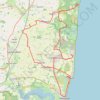
Dunwich to Aldborough loop ride

United Kingdom > England > Suffolk > East Suffolk > Dunwich

Distance: 36.2 mi • Elevation gain: 1,155 ft • Maximum elevation: 135 ft

Gear up for your next adventure:

💧Water Filtration Bottles - Safely drink from streams and lakes while exploring
🌎3D Topographic Globes - Raised relief globes for a tactile understanding of geography
📌Outdoor GPS Map App - Apps and devices for digital topographic navigation
🗺️NatGeo Topo Maps - High-quality waterproof printed topographic maps of US Parks
📡GPS Antenna Upgrade - Enhance GPS reception in remote terrain

As an Amazon Associate, this site earns from qualifying purchases at no extra cost to you.