
Brandon trails
Click on a trail to view its statistics, map and profile.
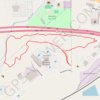
Brandon Quarry Loop Trail
United States > Mississippi > Rankin County > Brandon
The Brandon Quarry Loop Trail offers a moderately challenging hike through scenic landscapes near Brandon, Mississippi. The trail is popular for hiking and mountain biking, winding through wooded areas and offering tranquil views of the quarry, providing an enjoyable and peaceful outdoor experience. #Hiking…
Distance: 2.1 mi • Elevation gain: 46 ft • Maximum elevation: 371 ft
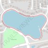
Lake Michaela Loop
United States > Florida > Hillsborough County > Bloomingdale
Distance: 0.9 mi • Elevation gain: 23 ft • Maximum elevation: 56 ft

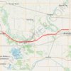
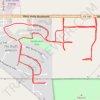
Afternoon Run
United States > South Dakota > Minnehaha County > Brandon
Distance: 4.3 mi • Elevation gain: 184 ft • Maximum elevation: 1,447 ft