
Cascade County, Montana, United States trails
Click on a trail to view its statistics, map and profile.
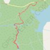
Virginia Falls and Saint Mary Falls from Saint Mary Lake in Glacier National Park
United States > Montana > Glacier County
The hike to Virginia and Saint Mary Falls is a delightful adventure for nature lovers! As you meander along the trail, you'll be treated to stunning views of rugged mountains like Little Chief and Dusty Star, while the lush greenery envelops you in a serene atmosphere. The highlight, of course, is witnessing…
Distance: 3.8 mi • Elevation gain: 751 ft • Maximum elevation: 4,908 ft
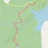
Virginia Falls and St. Mary Falls in Glacier National Park
United States > Montana > Glacier County
The St. Mary and Virginia Falls Trail in Glacier National Park offers a captivating journey through diverse landscapes. Starting near St. Mary Lake, hikers traverse areas affected by past wildfires, providing a unique contrast between new growth and charred remnants. Along the path, the trail meanders…
Distance: 3.8 mi • Elevation gain: 758 ft • Maximum elevation: 4,911 ft