Import a GPX file

LacDeBois trails

Click on a trail to view its statistics, map and profile.

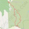
Mara Hill

Canada > British Columbia > Thompson-Nicola Regional District > Kamloops

Lac De Bois Grasslands Protected Area. #Hiking #Loop #Mara #LacDeBois

Distance: 5.4 mi • Elevation gain: 1,808 ft • Maximum elevation: 2,923 ft

Gear up for your next adventure:

🧤Tactile Hiking Gloves - Keep hands warm while operating GPS and smartphone screens
🚑Emergency Bivvies - Heat-reflective sleeping bags for survival situations
🥩Freeze-Dried Meals - Nutritious and lightweight food for remote expeditions
🛶Inflatable Kayak - Portable kayak for rivers, lakes, and expeditions
🏔️Mountain Trail Maps - High‑detail maps for popular peaks

As an Amazon Associate, this site earns from qualifying purchases at no extra cost to you.