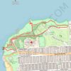
Lands End Loop trails
Click on a trail to view its statistics, map and profile.
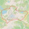
Chain Lakes Loop Trail
United States > Washington > Whatcom County
The Chain Lakes Loop Trail explores the dramatic alpine landscape of the Mount Baker–Snoqualmie National Forest, beginning here at Artist Point beneath the steep southern slopes of Table Mountain. The trail initially traverses open heather meadows and rocky terrain, with broad views toward Mount Baker, Mount…
Distance: 5.7 mi • Elevation gain: 1,972 ft • Maximum elevation: 5,472 ft
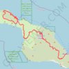
Trans Catalina Trail (TCT)
United States > California > Los Angeles County > Avalon > Pebbly Beach
The Trans-Catalina Trail begins in Avalon, leaving the island’s lively harbor town to climb into the dry, rugged interior of Santa Catalina Island. The route passes Haypress Reservoir and Cape Canyon Reservoir before entering the Black Jack backcountry and continuing toward Catalina Airport, often known as…
Distance: 38.7 mi • Elevation gain: 9,272 ft • Maximum elevation: 1,742 ft
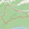
Endless Wall Trail via Diamond Point Overlook in New River Gorge National Park
United States > West Virginia > Fayette County > Lansing
The Endless Wall Loop Trail leading to Diamond Point Overlook offers a delightful escape into nature, showcasing the stunning landscapes of the New River Gorge. As you meander through lush forests and along cliff edges, you’ll encounter breathtaking views of the river far below, with the towering sandstone…
Distance: 2.8 mi • Elevation gain: 440 ft • Maximum elevation: 1,939 ft

Mount Washington Loop via Nelson Crag Trail, Lion Head and Crystal Cascades Falls
United States > New Hampshire > Coos County
This Mount Washington loop provides a rigorous yet rewarding adventure with diverse landscapes. Starting with a gentle forest walk on Old Jackson Road, the route quickly escalates into rockier terrain, with Nelson Crag offering panoramic views of the Presidential Range. As hikers descend via Lion Head, they…
Distance: 9.6 mi • Elevation gain: 4,449 ft • Maximum elevation: 6,270 ft
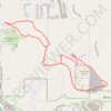
Table Rock Viewpoint and Table Rock Quarry Loop Trail
United States > Idaho > Ada County > Boise
The Table Rock Viewpoint and Quarry Loop Trail is a well-loved hike offering panoramic views of the city, the Boise River, and the surrounding foothills. Starting near the Old Idaho Penitentiary, this moderately challenging trail winds through sagebrush and grasslands, leading to a flat mesa with a prominent…
Distance: 3.8 mi • Elevation gain: 961 ft • Maximum elevation: 3,652 ft